General Information
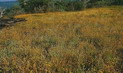
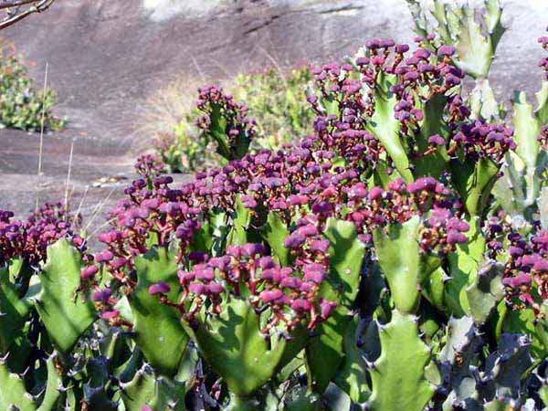
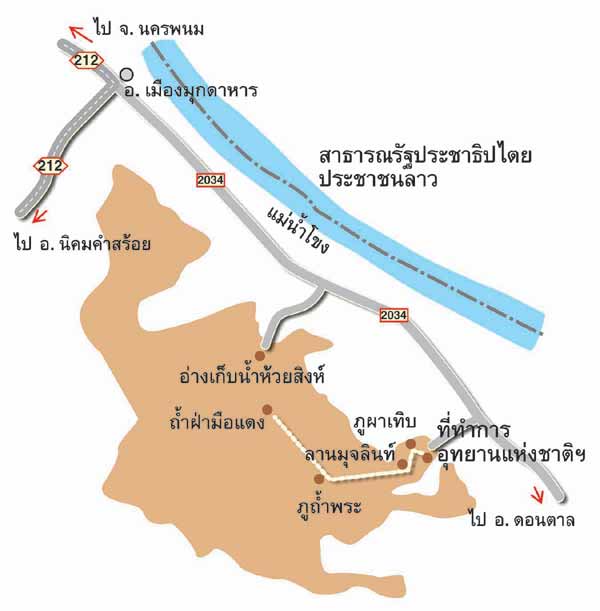
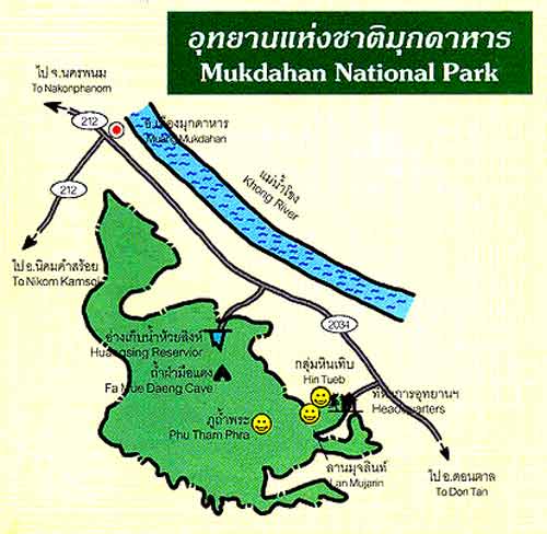
Mukdaharn National Park, in Muang District, Dontan District, Mukdaharn Province, consists of productive forest which has deciduous forest in rocky field or rocky mound covered with colorful flowers in winter, and mixed forest in the valley. There are naturally wonderful things such as strange-shape rock, historic cave, waterfall and spring all year round. And also many kinds of animal live there. The area is about 48.5 square kilometers or 30,312.5 Rai.
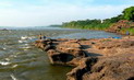
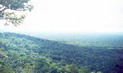
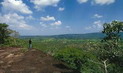
The area consists of many high mountains close to each other such as, Phu Nang Hong, Phu Thum Pra, Phu Hin Terb, Phu Mano and Phu Jongsi. Phu Jongsi, the highest peak about 420 meters above sea levels, is a rocky mountain consisting of erected and high cliff and different shapes of rock overlapping each other. The area, almost sandy soil, is the source of many streams such as Huai Taluak, Huai Sing and Huai
Ruar.
Climate
The weather in Mukdaharn National Park is three seasons.
Rains � from June to November
Winter � from December to January
Summer � from February to May
Flora and Fauna
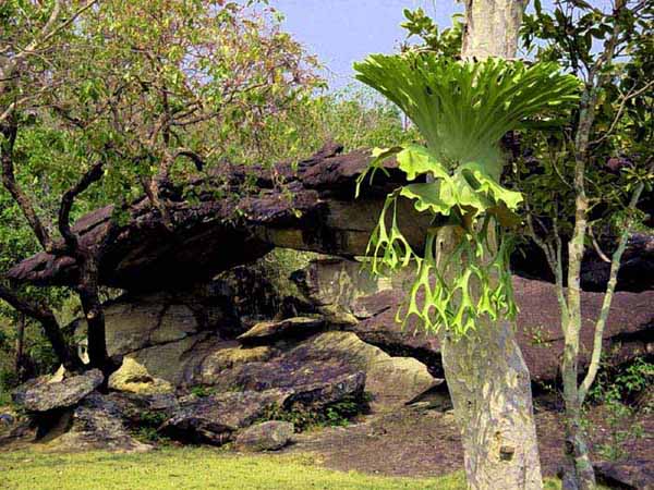
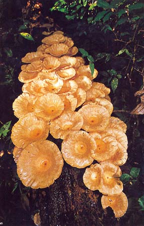
The forests in the area are naturally mixed forest and deciduous forest which has many kinds of plant such as Malabar ironwood, Burmese ebony, ironwood, Makhaa, rosewood, Krabog (a kind of Ixonantraceae), Krabark and Heang (a kind of Dipterocarpaceae), Indian oak, Tiew (a kind of Guttiferae), wild champaka, Moulmein cedar, Siamese sal and ingyin. And animals found are small-size animal such as wild boar, deer, jungle fowl, fox, monkey, hare, green peafowl, pheasant and many kinds of
bird.
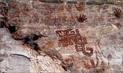
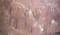
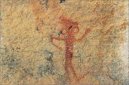
Phamua Dang Cave (Red Hand Cave)
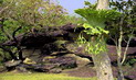
Phamua Dang Cave, a shred of rock three meters wide and 60 meters long, has red handprints on the wall. The two handprints look like people soak hand in red color and print on the wall. Other four handprints look like people put their hands on the wall and paint over. These may mean the information exchange of pre-historic people about 3,000 years ago. (It can be concluded that 3,000 years ago had no color spray)
Activities - Cave/Geological Touring - Historical Sight Seeing
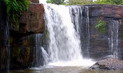
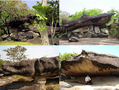
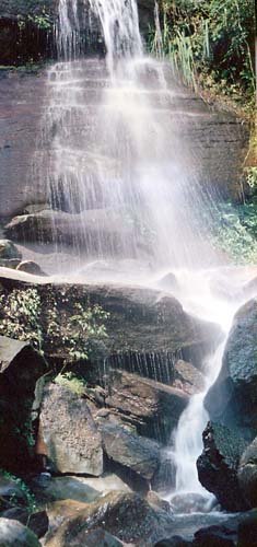
Phu Tam Pra
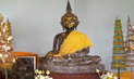
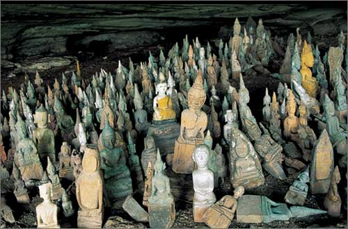
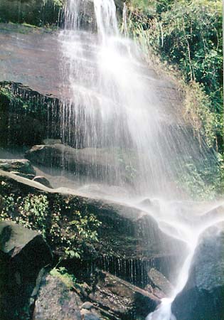
Phu Tam Pra is a waterfall which has water all the year round. Near the waterfall is a cave. In the cave has a three-foot-wide Buddha image built in 1972 and hundreds of wooden Buddha images and animal models. On the rocky floor nearby are the rocks eroded and shaped by rain to be strange and
beautiful.
Phu Luk Se
A tale has been told since ancient time that there was gold pillar, in the middle of the mound, called �Sao Se� (means in Phuthai word �losing pillar�) which later called Phu Lak Se. This area is unique by its dwarf forest, and view point.
Activities - View - flowers admiring
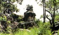
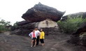
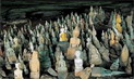
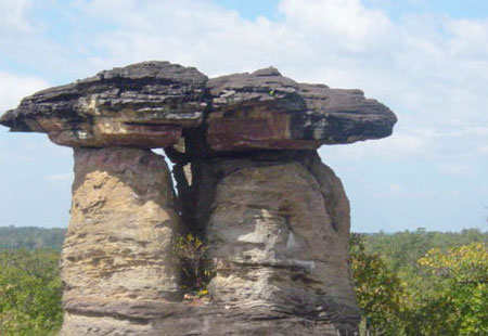
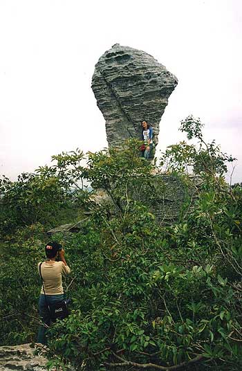
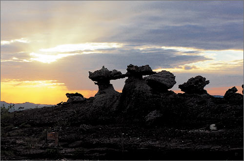
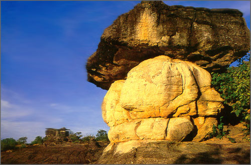
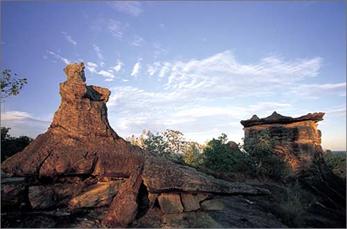
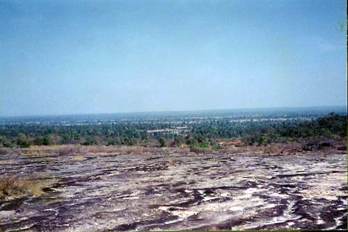
Phu Pha Terb
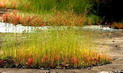
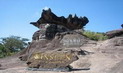
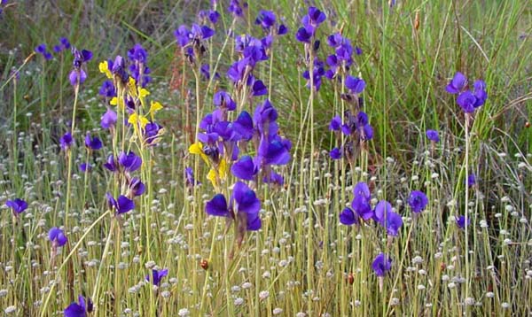
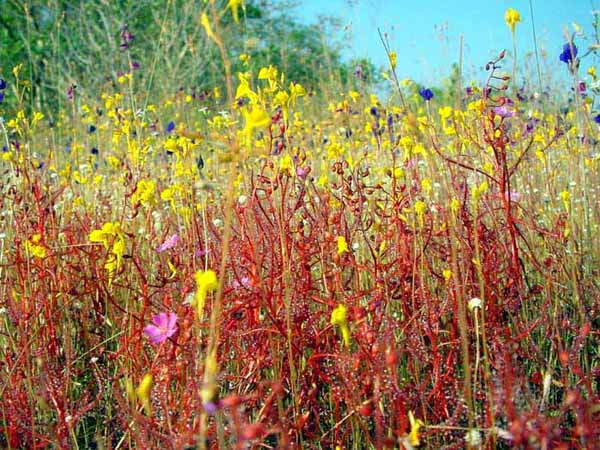
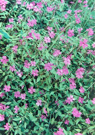
Phupa Terb, means rocks overlapping each other, has groups of different shape of rocks wonderfully overlapping each other on greatly wide and long plain of rock, all of which looks like natural sculpture, for examples, some rocks look like jet plane, boot, Chinese hut, crowd and stupa. At the rocky plain, there is deciduous forest which consists of beautiful dwarf-tree and many kinds of wonderful flower in rainy season.
Activities - flowers admiring - Cave/Geological Touring
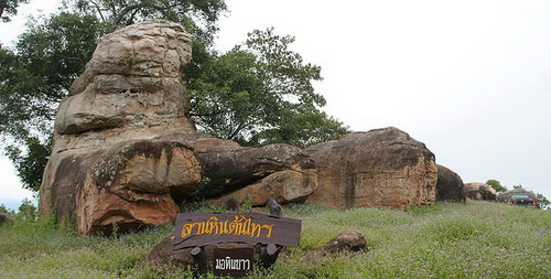
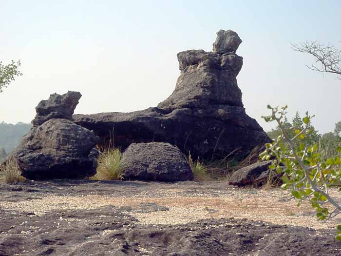
Phu Nang Hong
There is a natural big-rock looked like big swan in the middle of rocky plain. And also have many big rocks overlapping each other in different shape and color.
Activities - View
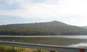
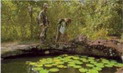
Wang Duen Ha
Wang Duan Ha, not so far from Mukdaharn National Park Office, is a pond which contains rainy water flown from rocky plain. Traveler can enjoy playing water here.
Activities - flowers admiring -
Thum Lord
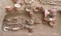
Thum Lord is a small cave which people can go down from a cliff for going further to Phu Nang Hong and Phu Lak Se. Local people found the remains of porcelain and antique of ancient people along the way to Phu Lak Se.
Activities - Nature trail study
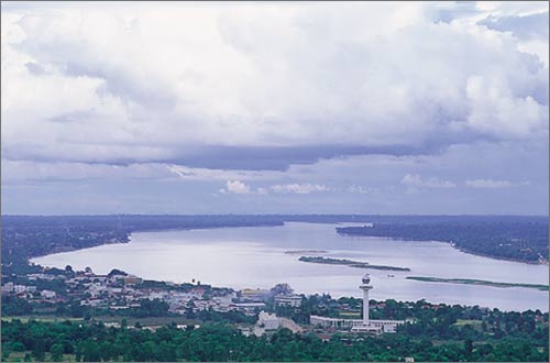
Phu Mano
On the top of Phu Mano, a mountain in the south of Mukdaharn Province, has a shelter and one-meter-deep model of Buddha footprints, traveler can beautiful sceneries of Mukdahan City, Khong River and Suwanakhet District, Lao People�s Democretic Republic.
Activities - View - Cultural Sight Seeing
Streams and Water Spring
The forest of the park is the source of streams such as Huai Taloua, Huai Ling and Huai Luar. Especially in Phu Tam Pra, the area has water all year round which is the source of Phu Tam Pra Waterfall.
Activities - View - flowers admiring
Contact Address
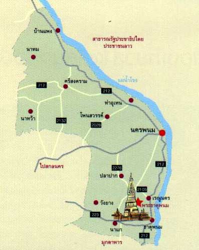
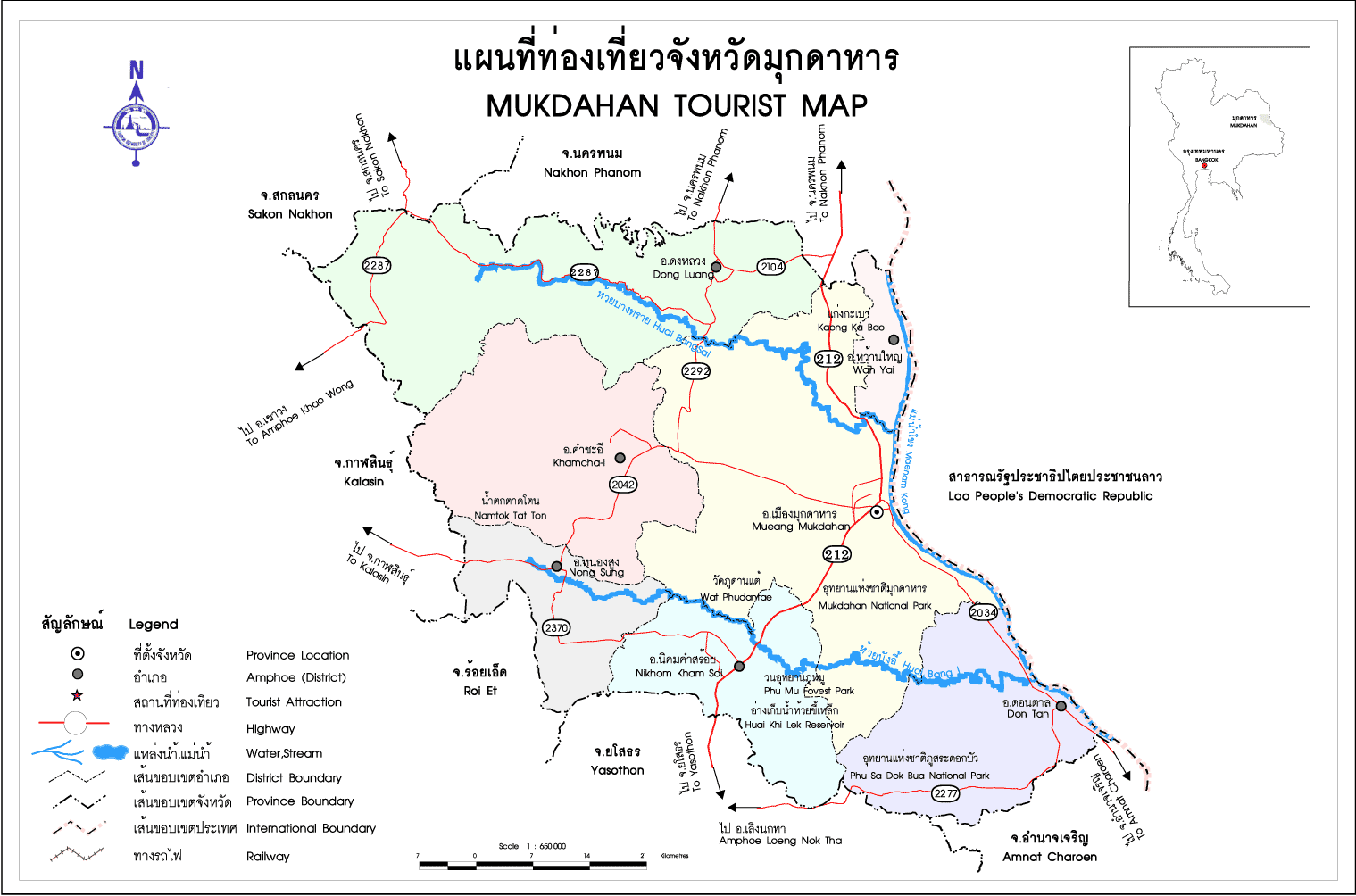
Mukdaharn National Park
Amphur Muang Mukdaharn Mukdaharn Thailand 49000
Tel. 0 4260 1753
How to go?
By Car
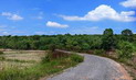
Mukdaharn National Park Office located in Phupa Terb, 17 kilometers from Muang District, Mukdaharn Province. Use tarmac road Mukdaharn � Dontan District about 14 kilometers and laterite road about two kilometers to enter Mukdaharn National Park Office.


 ต้อนรับเดือนศักดิ์สิทธิ์ ด้วยแพ็คเกจ “รอมฎอน ดีไลท์” ตั้งแต่วันนี้ ถึง 8 มิถุนายน 2562")