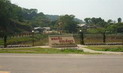
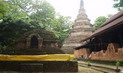
General Information
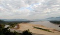
Hua Mae Kum Waterfalls Forest Park is located in Mae Salong Nai Sub-District, Mae Fah Luang District, Chiang Rai Province. It situated in Pa Naam Mae Kum, Pa Naam Mae Salong and the left side of Pa Naam Mae Chan National Reserves Forest covered the area of approximately 3,500 rais. The Royal Forest Department declaved this forest park on November 20, 1998
Topography
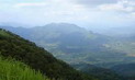
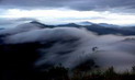
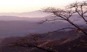
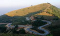
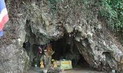
The area is mountainous with a very high Mountain range setting apart Thailand and Union of Myanmar. The area is 1,300-1,700 meters above mean sea level and an average slope all round of approximately 35-45%. Mountains in the area are quite rocky, however, covered by soils, where by the area around the waterfalls consists of magnificent layers of large and small
rocks.
Climate
Tropical Monsoon with influence from South-Westerly wind during rainy seasons and North-Easterly wind during winter. There are 3 seasons altogether in this area • summer from March to May (hot & humid), rainy season from June to September (wet & windy) and winter from October to February (very
cold).
Flora and Fauna
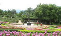
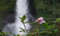
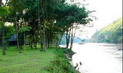
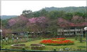
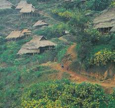
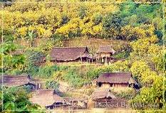
The area is generally covered in primary forest. There are not many trees on the mountains since agricultural activities had been carried out for many years. Around the open space, Bua Tong flowers can be found. In the valley, there are creeks with all year round water flows with thick and lush forest consisting of many trees perennials and ground covering plants such as ferns, liceuse grass and elephant£s ear. Perennials found are figs, ironwood, bamboos, evergreen chinkapin, bauhinia, ebony, jute, paper mulberry, coral tree, emblic leaf flower, sesban and toothbrush
tree.
Common wildlife are civet, wild hare, and birds.
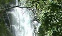
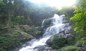
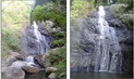
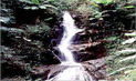
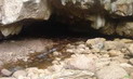
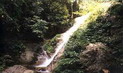
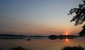
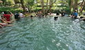
Waterfalls and Bua Tong fields
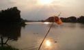
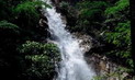
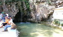
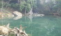
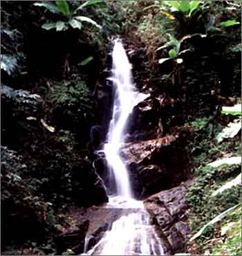
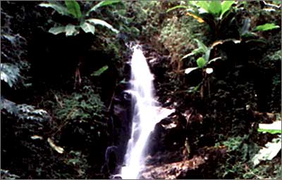
Waterfalls and Bua Tong fields is situated on the mountain top 1,400 meters above mean sea level. Because the area is very high, water flows throughout the year from Sub-Cuek of Mae Kum River originating from Mae Kum River. There is also another 2 storey high waterfalls around Poang Lee Creek area, with each storey being approximately 5-10 meters high. Along Mae Kum Creek, there are approximately 20 other waterfalls, each at around 1-5 meters in height. Besides the waterfalls, there are also Bua Tong flowers all around the mountain which will fully bloom in the
winter.
Contact Address
Namtok Hua Mae Kham Foerst Park
Mae Salong Nai Sub-district, Amphur Mae Fa Luang Chiang Rai Thailand 57110
Tel. 0 5371 4914 Fax 0 5371 1961 E-mail
reserve@dnp.go.th
How to go?
By Car
From Muang District, Chaing Rai Province to Mae Chan District (30 kilometers). From Mae Chan-Mae Salong Junction to the Junction leading to Baan Terdthai (23 kilometers up hills). Another 13 kilometers to Baan Terdthai itself, then, another 37 kilometers to Hua Mae Kum Waterfalls Forest Park via Baan Na Doh and Baan Paang Mahan. Total distance from Muang District, Chiang Rai province to Hua Mae Kum Waterfalls Forest Park is approximately 103 kilometers.


 ΔιΆΝΌ≈Ζ―η«δΜ
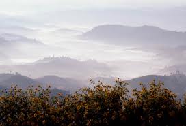


 ύΗïύΙâύΗ≠ύΗôύΗΘύΗ±ύΗöύΙÄύΗîύΗΖύΗ≠ύΗôύΗ®ύΗ±ύΗ¹ύΗîύΗ¥ύΙ¨ύΗΣύΗ¥ύΗ½ύΗ‰ύΗ¥ύΙ¨ ύΗîύΙâύΗßύΗΔύΙ¹ύΗûύΙ΅ύΗ³ύΙÄύΗ¹ύΗà βÄ€ύΗΘύΗ≠ύΗΓύΗéύΗ≠ύΗô ύΗîύΗΒύΙ³ύΗΞύΗ½ύΙ¨βÄù ύΗïύΗ±ύΙâύΗ΅ύΙ¹ύΗïύΙàύΗßύΗ±ύΗôύΗôύΗΒύΙâ ύΗ•ύΗΕύΗ΅ 8 ύΗΓύΗ¥ύΗ•ύΗΗύΗôύΗ≤ύΗΔύΗô 2562")