General Information
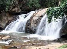
Mae Toh Waterfalls Forest Park is located in Wiang District, Amphur Wiang Pah Pao, Chiang Rai Province and Sufuated in Pa Mae Poon Noy, Pa Mae Poon Luang and Pa Huay Poang Men National Forest Reserves. The total area is approximately 4,000 rais and the Royal Forest Department declaved as a Forest Park on November 9, 1997.
Topography
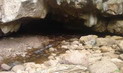
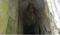
Area of the Mae Toh Waterfalls Forest Park is part of the mountain range, with and average of 40% slope, situated at a level of 600-965 meters above average sea level. There is Mae Toh Creek which runs through the middle of the area, Hin Toh Creek which runs through the Northern side, Looh Creek which runs through the Southern side and Mae Poon Luang River which runs through the Eastern side of the
area.
Flora and Fauna
Dry everygreen forest. Common vegetations found are Ironwood, Yang, Neem tree, Makhaa Moang, longan and mango. Grounds covering plants common in the area are bamboos, bananas, galangals and
ferns.
Common wildlife are deer, wild pig, red junglefowl, mouse deer, jungle cats, civet, birds, amphibians and
reptiles.
Contact Address
Namtok Mae Tho Forest Park
Weiang Sub-district, Amphur Wiang Pa Pao Chiang Rai Thailand 57170
Tel. 0 5371 4914 Fax 0 5371 1961
How to go?
By Car
Take Highway No.1 from Chiang Rai province to Mae Saruay Junction (total of 22 kilometers) then take Highway No.1019 to Wiang Pah Pao District (total of 66 kilometers) then take local road to Baan Mae Poon Laang (total of 10 kilometers) then turn into secondary route to Mae Toh Waterfalls (total of 10 kilometers).


 ύΗïύΙâύΗ≠ύΗôύΗΘύΗ±ύΗöύΙÄύΗîύΗΖύΗ≠ύΗôύΗ®ύΗ±ύΗ¹ύΗîύΗ¥ύΙ¨ύΗΣύΗ¥ύΗ½ύΗ‰ύΗ¥ύΙ¨ ύΗîύΙâύΗßύΗΔύΙ¹ύΗûύΙ΅ύΗ³ύΙÄύΗ¹ύΗà βÄ€ύΗΘύΗ≠ύΗΓύΗéύΗ≠ύΗô ύΗîύΗΒύΙ³ύΗΞύΗ½ύΙ¨βÄù ύΗïύΗ±ύΙâύΗ΅ύΙ¹ύΗïύΙàύΗßύΗ±ύΗôύΗôύΗΒύΙâ ύΗ•ύΗΕύΗ΅ 8 ύΗΓύΗ¥ύΗ•ύΗΗύΗôύΗ≤ύΗΔύΗô 2562")