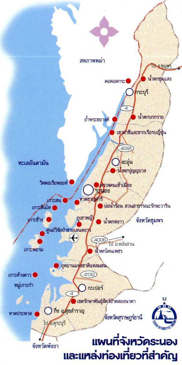
General Information
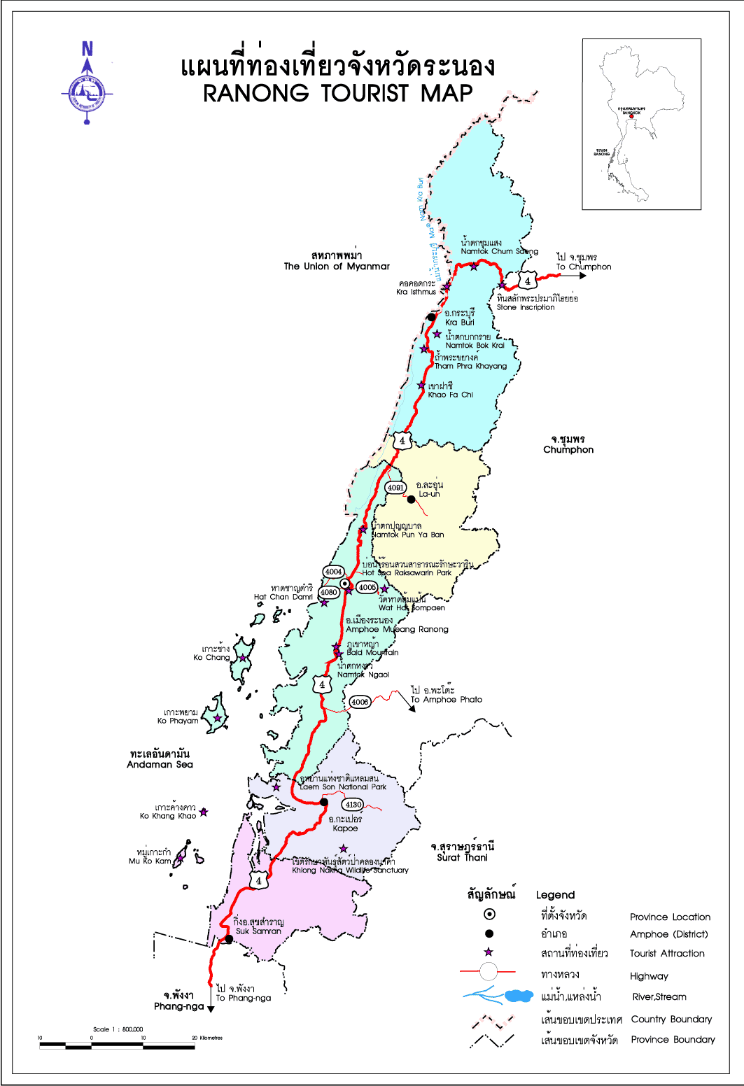
The Royal Forest Department had directed the National Park Division officers to go on a field trip to carry out a survey on the area of the National Reserved Forest comprising Khlong Lam Liang-La-Un Forest, La-Un Forest Un-Pa Forest Ratchakut Forest, Khlong Set Kuat Forest, Khao Hin Chang Forest and Pa Khao Sam Laem Forest in order to classify the above National Forest Reserved area into a national park, which on 21st April, 1999, the above said area was announced as a national park called Lam Nam Kraburi National Park with the total area of approximately 160 sq.km, comprising of 61 sq.km of water and 99 sq.km of land.
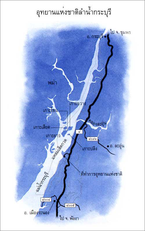
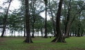
Lam Nam Kraburi National Park covers the area of approximately 160 sq.km, consisting of Kraburi River, parting Thailand and Myanmar, small islands scattering along Kraburi River and Mangrove Forest by the Kraburi River banks and the National Reserved Forest area consisting of Khlong Set Kuat Forest, Khao Hin Chang Forest, Khao Sam Lam Forest, La-Un Forest Ratchakut Forest and Khlong Lam Liang-La-Un National
Forest.
Climate
The average lowest temperature in the Lam Nam Kraburi National Park is 13.7 degree Celsius and the average highest temperature is 34 degree Celsius with average rainfall at 4,276 millimeters/year. The best months and the most suitable period for tourism are between January and
April.
Vegetation
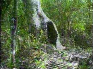
Tropical Rain Forests can be found around Khlong Set Kuat Forest, Khao Hin Chang Forest, Khao Takian Forest and La-Un Forest /Ratchakut Forest National Forests and the most distinctive vegetation found only in this area is Khun Mai with large, straight trunk and cashew nut like seeds. Such vegetation is found around Punyaban Falls, La-Un Forest/Ratchakut Forest National Reserved Forest and Mangrove Forest.
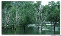
Other distinctive vegetations are large leaves and small leaves Mangroves, Prong, Xylocarpus moluccensis, Xylocarpus granatum, Bruguiera Sex angula, Avicennia marina, Sonneratia and Beans.
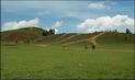
Grass hills, on the other hand, cover the area of approximate 1.6 sq.km. Such area was formerly the growing plots which were repeatedly destroyed by fire but have been revived into the existing grass hills
today.
Wildlife
Mammals including Panthera tigris, Neofelis nebulosa, Asiatic black bears, mongoose, bats and civets can be found in this area while birds, for example, can be found easily around the National Park Office. As for amphibians, those which can be found around the Kraburi River are toads and frogs.
Aquatic Life
Consists of saltwater eels, carps, mackerels, mudskippers, crabs, and Kraburi River
prawns.
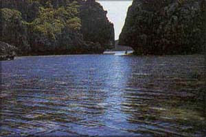
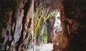
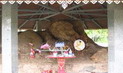
Tham Yi Pun
Situated on Ko Khwang and is 500 meters in depth. Formerly a Japanese Military Base during World War 2
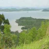
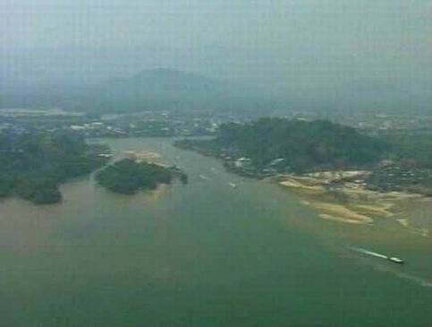
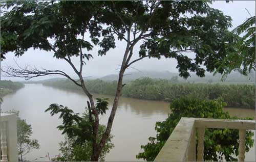
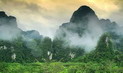
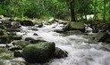
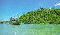
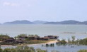
Kra Buri River
The Kra Buri River, the border between Thailand and Myanmar, is 60 km along from source to mouth, and 6 km wide. The river banks are natural and there are a number of islnad groups. The whole boundary area of Thailand and Myanmar has healthy mangrove forests, and has a high potential for river tourism, such as rafting and boat trips. In the future when the Lam Nam Kra Buri National Park boundary has been officially declared, cooperation between Thailand and Myanmar in organising tourism for the Kraburi River area can be enhanced. From the Isthmus of Thailand, following the river down to Ko Song or Victoria Point Island in Myanmar, arises a National Park between countries, which has the highest potential in tourism and conservation. This will lead to good relations and further opportunities for cooperation between Thailand and
Myanmar.
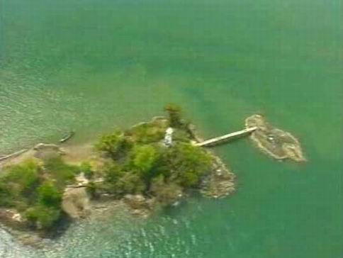
Islands of the Kra Buri River
Consisting of 6 islands namely Siat Island, Khwang Island, Yao Island, Khon Island, Pling Island, and Nok Plao Island which are situated right in the middle of the river with the most perfect mangrove forest and absolutely no population whatsoever. Khwang Island, however, is the exception since there is a land concession of 0.35 sq.km, whereby such concession will be expired in March 2, 2013.
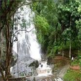
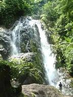
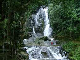
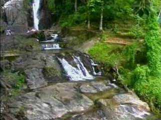
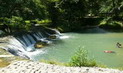
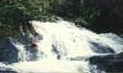
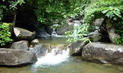
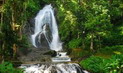
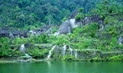
Punyaban Waterfall
Punyaban Waterfall is an all year round falls by Petchkasem Road Km.598 with the average number of 100,000 tourists visiting per year. The originating point of this fall is La Un/Ratchakut National
Forest.
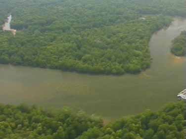
Sed Kuad Peninsular
Sed Kuad Peninsular is an area of healthy mangrove forest, the tip of which stands out into thr Kraburi River. It is located in the National Park Headquarters area, covering an area of approximately 3.2 sq.km.
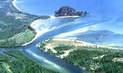
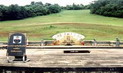
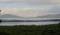
The Viewpoint at Khao Hin Chang, National Park Headquarters, gives a panoramic view of the Kraburi River, the islands, mangrove forests, and a clear view of the river banks on Myanmar side of the
border.
Khao Hin Chang View Point
Situated in the area of Khao Hin Chang and is the point where Kraburi River, its islands and the mangrove forest, along with the Myanmar scenery can be viewed widely and
clearly.
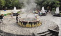
Bo Namron Had Yai
A total of 3 hot springs are located in Mu 2, Tambon Bang Phra Nua, La Un District, Ranong Province, and around the Had Yai Ranger
Station.
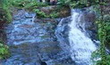
Ton Pak Waterfall
3km far from Ranger Station 1 (Hat Yai). Located Moo 2 Tambon Bang Phar Nuen Amphur La-oon Ranong province. It's has 4
levels.
Contact Address
Lam Nam Kraburi National Park
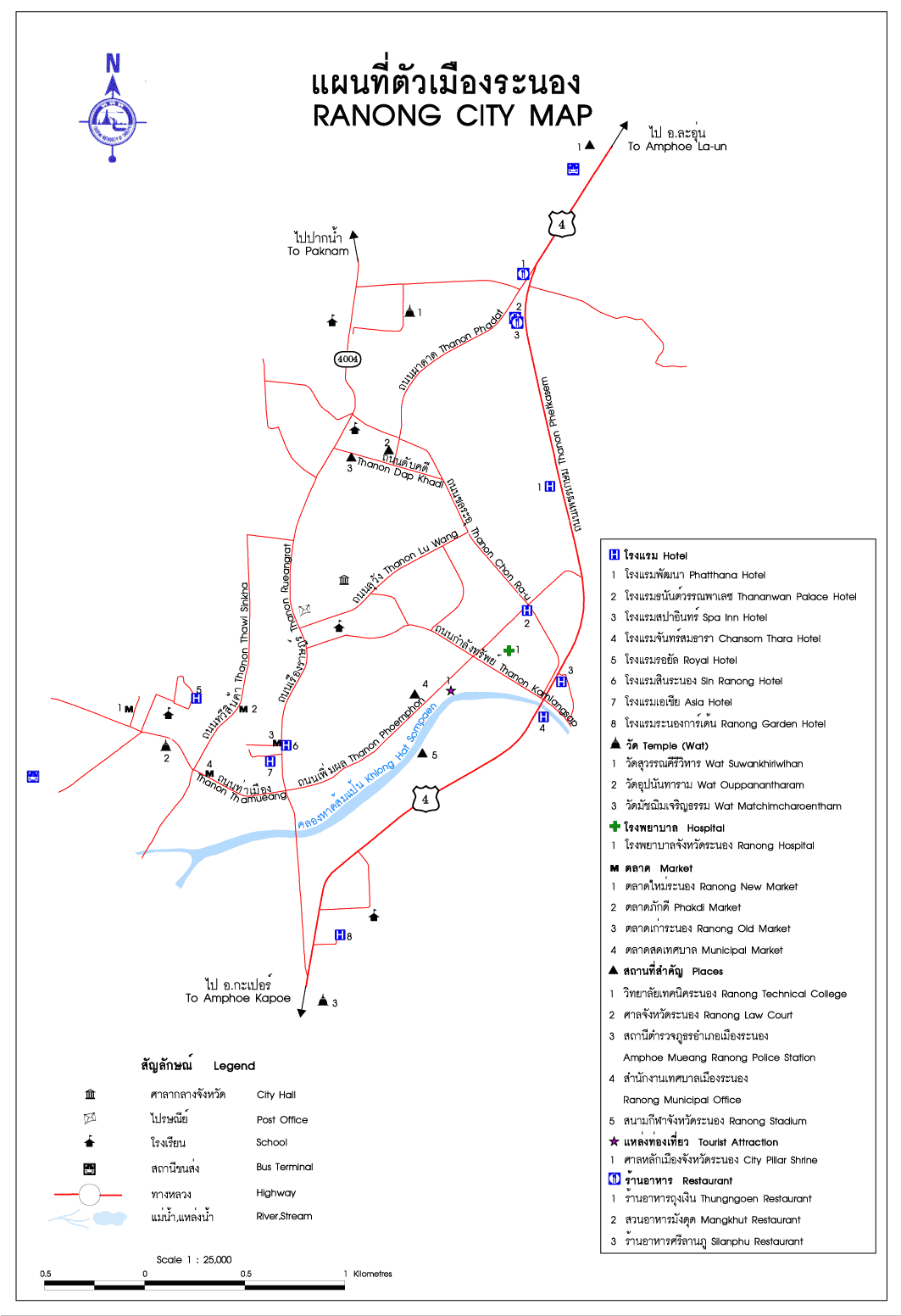
130, Mu 3, Ban Hin Chang, Phetkasem rd, Paknam Sub-district, Amphur Muang Ranong Ranong Thailand 85000
Tel. 0 1229 0563
How to go?
By Car
Buses from Ranong Province to the National Park Office (approximately 18 kilometers) are operating daily from 7.00am – 4.00pm. Another alternative is to take buses from Bangkok which will reach the entrance of the National Park 18 kilometers before actually reaching the town of Ranong.